• The SH Membership has gone live. Only SH Members have access to post in the classifieds. All members can view the classifieds. Starting in 2020 only SH Members will be admitted to the annual hunting contest. Current members will need to follow these steps to upgrade: 1. Click on your username 2. Click on Account upgrades 3. Choose SH Member and purchase.
  • We've been working hard the past few weeks to come up with some big changes to our vendor policies to meet the changing needs of our community. Please see the new vendor rules here: Vendor Access Area Rules

Map Scouting a new property

Jayo

Member
Joined
Oct 23, 2019
Messages
59
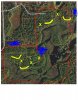
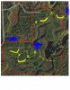
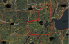
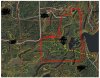
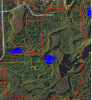
What do you think of this property from a map scouting perspective? It is a 120 acre piece that can be accessed by road in the left hand corner on the west side of the property. Could access by boat as well but I wouldn't have that option. Where would you start your focus?
 

Attachments

  • new hunting spot.PNG
    new hunting spot.PNG
    1.3 MB · Views: 64
Last edited:
I see several good funnels. Several saddles. Looks like a good place. Just depends on pressure and accessibility to your spots. Good luck!
 
I see several good funnels. Several saddles. Looks like a good place. Just depends on pressure and accessibility to your spots. Good luck!

agreed, the funnel at top right looks good and the saddles by the road look like a good starting point as well
 
This is what I would look at first. Marked with X's are saddle/funnel spots and yellow lines are leeward (assuming North wind) side of hills/ridges.
 

Attachments

  • mark up new.jpg
    mark up new.jpg
    352.3 KB · Views: 57
I would also not be surprised to find a prominent trail around the tip of that water shown by the dotted line. Only boots on the ground will confirm any of this, of course. It looks like a really good property. Is there any Agriculture nearby that might focus travel patterns?
 

Attachments

  • mark up new 2.jpg
    mark up new 2.jpg
    353.3 KB · Views: 38
There are 2 spots from this marked map that I would try that are overlooked and not marked. But I’m having a hard time with getting the map up to where I can mark it. Sorry
 
There are 2 spots from this marked map that I would try that are overlooked and not marked. But I’m having a hard time with getting the map up to where I can mark it. Sorry
Save the map, copy and paste it into publisher, then mark it up and save it. Then upload it with the attach file button.
 
Save the map, copy and paste it into publisher, then mark it up and save it. Then upload it with the attach file button.

Yeah, i'd like to see the possible over looked spot where a deer like in your profile picture will be walking LOL!
 
The overlooked spot is exactly where I got that buck this past year. Lol! 172” on public.
Crazy!! Good job. I don't think they get that big in Northwestern Wisconsin on public!!
I would also not be surprised to find a prominent trail around the tip of that water shown by the dotted line. Only boots on the ground will confirm any of this, of course. It looks like a really good property. Is there any Agriculture nearby that might focus travel patterns?

The ag fields are relatively far away. There are a few a half mile south of the property but other than that the nearest ones are a few miles, at least.
 
The overlooked spot is exactly where I got that buck this past year. Lol! 172” on public.
Describe where the spot is on the map and its features. I am very interested. Thanks. Nice buck by the way!
 
Crazy!! Good job. I don't think they get that big in Northwestern Wisconsin on public!!


The ag fields are relatively far away. There are a few a half mile south of the property but other than that the nearest ones are a few miles, at least.
Half a mile is a pretty good distance. It is possible they could travel that far if the food source was very tempting. I would scout for mast producing trees on the property first and identify those.
 
I'd scout the points on either side of the marsh in the lower left (SW) and the area around the smaller growth, especially the isolate island with one orange circle in the sorta NE sector.
 
I like the edges highlighted in Yellow with a predominately westerly wind. I generally find trails running along transitions perpendicular to the predominate wind direction. The problem I see is access. It's going to be tough to get in there undetected with a westerly wind. You're either going to get winded or seen from most of the bedding positions.

On a slight northwesterly wind I'd sneak in on the purple line and try to set up in the corner where the X is. If the wind is slightly southwesterly then I'd sneak in on the other side and setup on that point, just around the corner (light blue line). In either case I'd set up just out of sight of any deer that may be bedded on that sidehill marked in yellow. They should be facing the open downwind area.


1653355639061.png
 
Looking at the surrounding area I can see potential for the travel to be likely along the yellow line more than I thought from the first photo.
 

Attachments

  • mark up 4.jpg
    mark up 4.jpg
    398.6 KB · Views: 17
lol, have we covered the whole property yet with annotations of where the big boy is?

Let us know, boots on ground. New property is a blast.
 
Back
Top