• The SH Membership has gone live. Only SH Members have access to post in the classifieds. All members can view the classifieds. Starting in 2020 only SH Members will be admitted to the annual hunting contest. Current members will need to follow these steps to upgrade: 1. Click on your username 2. Click on Account upgrades 3. Choose SH Member and purchase.
  • We've been working hard the past few weeks to come up with some big changes to our vendor policies to meet the changing needs of our community. Please see the new vendor rules here: Vendor Access Area Rules

Spartan Forge Desktop App Takes Monumental Leap

I did compare OnX and SF at the time. OnX was better, which made me think it was the SF app not my phone/gps in general. I did just get a system update so maybe that'll take care of it
Interesting. Let us know if it does it again if you can.
 
Just officially broke up with OnX. Told 'em the usual. It was me, not them. They're great and I'm sure they'll find someone else and be even happier.

Don't worry about me, though. I'm already seeing someone else.
 
Screenshot_20231011_114404_Spartan Forge.jpg

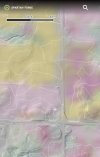
So looks like yellow should be corn/ grains . Just what the heck is the other pinkish color? New owner doesn't make sense, some of that it public land. Pretty sure I didn't miss a fruit farm there either haha. Comes on and off with ag layer. Slope angle is off
 
View attachment 92460

So looks like yellow should be corn/ grains . Just what the heck is the other pinkish color? New owner doesn't make sense, some of that it public land. Pretty sure I didn't miss a fruit farm there either haha. Comes on and off with ag layer. Slope angle is off

Yea I’ve got purple green yellow brown and pink on my map with the ag filter but no legend and no way to tell if that’s current or past
 
Yea I’ve got purple green yellow brown and pink on my map with the ag filter but no legend and no way to tell if that’s current or past
My corn wasn't corn either, not this year anyway. There was a little bit of left over corn stalks but I'm not even sure they were last years. Seemed to be fallow to me
 
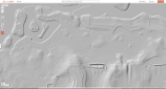
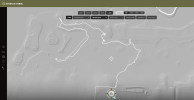
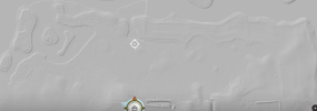
So here's side by side comparison of SpartanForge and CalTopo's LiDAR. This particular area in AL has good data for CalTopo. I haven't looked around and compared the two anywhere else. In this specific case, it looks like CalTopo still has the better imagery. They're very close though.
 

Attachments

  • CalTopo-LiDAR.PNG
    CalTopo-LiDAR.PNG
    739.3 KB · Views: 18
  • Spartan-Forge-LiDAR.PNG
    Spartan-Forge-LiDAR.PNG
    405.2 KB · Views: 18
Yea I’ve got purple green yellow brown and pink on my map with the ag filter but no legend and no way to tell if that’s current or past
Well I'm here to tell everyone that I did in fact miss the fruit farm.

The pinkish in that particular area is apple trees. Seems like the more intense the color the more apples trees there are. So a real faint blob is probably only 1 or 2 but the deeper color spots are a group of them. I'll try to keep an eye out for other colors to see if I can identify those.

Also my corn that isn't corn was corn last year, I was told by another hunter Saturday. I guess take that info with a little salt
 
So here's side by side comparison of SpartanForge and CalTopo's LiDAR. This particular area in AL has good data for CalTopo. I haven't looked around and compared the two anywhere else. In this specific case, it looks like CalTopo still has the better imagery. They're very close though.
This is my neck of the woods. Found it to be very good.
5c3ed24cb93b9da7c575f27da662cbb7.jpg


Sent from my SM-A526U1 using Tapatalk
 
So here's side by side comparison of SpartanForge and CalTopo's LiDAR. This particular area in AL has good data for CalTopo. I haven't looked around and compared the two anywhere else. In this specific case, it looks like CalTopo still has the better imagery. They're very close though.
Seems to vary a lot around the same area. I agree this isnt the best looking area that i have seen.
1702690821755.png
 
So I imported my waypoints from onX and now I have 1000 question marks that I can't delete unless I do it individually. I am not going to spend the time to rename them all because I am not insane. Does anyone know how to delete them? Thanks
 
So I imported my waypoints from onX and now I have 1000 question marks that I can't delete unless I do it individually. I am not going to spend the time to rename them all because I am not insane. Does anyone know how to delete them? Thanks

Simplest thing to do would be to delete the app then reinstall. Of course if you've created new spots with SF you'll lose those
 
Simplest thing to do would be to delete the app then reinstall. Of course if you've created new spots with SF you'll lose those
yea that ain’t the solution, thanks though. If I’m doing that it’s staying deleted and I’ll be requesting a refund. Reached out to customer service maybe they’ll be able to help.
 
I’ve enjoyed a lot of the app, honestly the weather is more accurate than about any other source I view. I like the movement and pattern things but they don’t get me in the woods more or less. From my experience the boundary lines have not been accurate so I stick to OnX for that. I also haven’t been able to find all the public with them I can with OnX.

Overall I think they do cool stuff and are developing something good for whitetail hunters but if there is a price increase I won’t renew. If it stays the same I’ll probably buy both again but if my monetary circumstances change and I only got one this wouldn’t be it.
 
I think OnX has better aerial photos which are more helpful where I am since everything is pretty flat - and CalTopo has free shaded relief to view.

I like SF interface, look and feel better, and I like that they offer all of the US for one price, unlike OnX which is double for all 50 states.
 
I'm definitely getting more comfortable/ yard to SF but for $60 next year I think I'm going back to OnX. Or maybe huntstand
 
I'm definitely getting more comfortable/ yard to SF but for $60 next year I think I'm going back to OnX. Or maybe huntstand
Yeah, when I saw that the 2nd year was more expensive I thought to myself, "they've got a lot of crap to fix in 1 year."

Although for what it's worth, I haven't had another crash. Compass is accurate enough that I've been relying on it solely for short (<.25 mile) walks. And LiDar is sweet in a swamp.

But there are enough problems that I wouldn't fool with it if I lived in a hillier region. Property lines are abysmal and pin management sucks.
 
I didn't know they had went up to $60/yr. I'm a $20/yr early adopter. If they take that away, I'll be looking hard at Huntstand Pro again.
 
Back
Top