
-
The SH Membership has gone live. Only SH Members have access to post in the classifieds. All members can view the classifieds. Starting in 2020 only SH Members will be admitted to the annual hunting contest. Current members will need to follow these steps to upgrade: 1. Click on your username 2. Click on Account upgrades 3. Choose SH Member and purchase.
-
We've been working hard the past few weeks to come up with some big changes to our vendor policies to meet the changing needs of our community. Please see the new vendor rules here: Vendor Access Area Rules
You are using an out of date browser. It may not display this or other websites correctly.
You should upgrade or use an alternative browser.
You should upgrade or use an alternative browser.
Spartan Forge Platform Now Offers LIDAR
- Thread starter BackSpasm
- Start date
- Joined
- Apr 16, 2019
- Messages
- 691
Does anyone know if you can layer topo and satellite of your choosing on SF? I use the hybrid layer on OnX quite a lot.
Bottom right on the screen there’s an icon that looks like a gear. Mash that and you can layer till your heart is content.
Attachments
Yes, use the lamba custom map function and you can even choose your topo intervals on top of what basemap you wantDoes anyone know if you can layer topo and satellite of your choosing on SF? I use the hybrid layer on OnX quite a lot.
Or just get the app already. We dont told you it is better than doe in heat scented boot soles. Whatcha waitin fer?
- Joined
- Nov 1, 2018
- Messages
- 9,350
I got the app playaOr just get the app already. We dont told you it is better than doe in heat scented boot soles. Whatcha waitin fer?
Anybody else's spartan forge crashing constantly today?
Gotta say, I'm getting to the point where I dislike everything but the lidar
Gotta say, I'm getting to the point where I dislike everything but the lidar
- Joined
- Nov 1, 2018
- Messages
- 9,350
What does your phones storage look like? Not that it’s highly likely but maybe check that you’re not close to maxed out. These mapping apps are data hogs. What else don’t you like about it? I’ve been enjoying using mine surprisingly.Anybody else's spartan forge crashing constantly today?
Gotta say, I'm getting to the point where I dislike everything but the lidar
Mine has been fine, haven't used it a bunch but the little bit I did was perfectly fine. When was the last time your phone died or was restarted? My phone's getting older and anytime things get janky a restart helps
Sent from my Pixel 3 using Tapatalk
Sent from my Pixel 3 using Tapatalk
67% storage utilization. Shouldn't be the issue. After 2 restarts and 2 uninstall/reinstalls of the app it appears to be working. But in 12 or more years I've never had that issue with Huntstand. I got caught in the woods today, halfway towards a pin in the swamp, with nothing but a compass. Wasn't able to rectify the issue in the field. Had to navigate with my compass and find my duck hole the long way by navigating to a creek from memory and following the bank.What does your phones storage look like? Not that it’s highly likely but maybe check that you’re not close to maxed out. These mapping apps are data hogs. What else don’t you like about it? I’ve been enjoying using mine surprisingly.
Not a huge problem, but if it happens opening day of duck season at 3am, I'm gonna be bent. I've reinstalled huntstand as a backup.
Other things I'm not a fan of:
- Can't filter pins. For example, I drop pins for turkey, deer, ducks, hogs, mushrooms, and small game. For this weekend, I'd like the option to eliminate all pins but duck pins. Can't do that.
- The shared hunt areas (blue balls or whatever it's called) is janky. Sometimes pins share, sometimes they don't. Usually it seems they don't.
- Related to above, when you create a shared area, it shades the whole area a stupid shade of blue that I can't turn off. May be operator error.
- Property lines on one property I hunt are off by about 300ft.
- May be operator error, but I don't see an option for hunt "areas" except for offline maps. On huntstand, I can have as many hunt areas saved as I like. I can scroll down a list to a property, click it, and it pulls that area and all of the pins up on my screen. I can close it and go to a new one in a whole different county. I can also have multiple "areas" that are all the same property, but create different maps of the same area. I like to do that to have one area that is just scouting pins, and one that is "spaghetti maps" with breadcrumb trails of every time I walk the property. I use this to identify overlooked areas, thick brush, and swampy areas that probably hold deer because I and others walk around it. With spartan Forge, it defaults to showing me my current location every time I open the app, and I have to navigate from there.
- Huntstand had monthly aerials that were low-res, but useful for showing recent logging activity. Can't find that on Spartan Forge.
- Joined
- Mar 8, 2022
- Messages
- 4,122
One thing I greatly dislike in SF is if you make a pin and add a picture via camera in the app, it's only in app at that pin. And a silly size you can't zoom. I think onX puts the picture in the usual spot on your phone too, where it's easy to find, zoom, share whatever
- Joined
- Nov 1, 2018
- Messages
- 9,350
67% storage utilization. Shouldn't be the issue. After 2 restarts and 2 uninstall/reinstalls of the app it appears to be working. But in 12 or more years I've never had that issue with Huntstand. I got caught in the woods today, halfway towards a pin in the swamp, with nothing but a compass. Wasn't able to rectify the issue in the field. Had to navigate with my compass and find my duck hole the long way by navigating to a creek from memory and following the bank.
Not a huge problem, but if it happens opening day of duck season at 3am, I'm gonna be bent. I've reinstalled huntstand as a backup.
Other things I'm not a fan of:
I guess it's not fair to say I hate everything but the Lidar. I like the wind rose too, and the compass seems to function better than on Huntstand. Weather data seems fine, and I really like the ability to associate a photo with a pin. But there seem to be pretty standard features that just aren't there or are crappy in comparison.
- Can't filter pins. For example, I drop pins for turkey, deer, ducks, hogs, mushrooms, and small game. For this weekend, I'd like the option to eliminate all pins but duck pins. Can't do that.
- The shared hunt areas (blue balls or whatever it's called) is janky. Sometimes pins share, sometimes they don't. Usually it seems they don't.
- Related to above, when you create a shared area, it shades the whole area a stupid shade of blue that I can't turn off. May be operator error.
- Property lines on one property I hunt are off by about 300ft.
- May be operator error, but I don't see an option for hunt "areas" except for offline maps. On huntstand, I can have as many hunt areas saved as I like. I can scroll down a list to a property, click it, and it pulls that area and all of the pins up on my screen. I can close it and go to a new one in a whole different county. I can also have multiple "areas" that are all the same property, but create different maps of the same area. I like to do that to have one area that is just scouting pins, and one that is "spaghetti maps" with breadcrumb trails of every time I walk the property. I use this to identify overlooked areas, thick brush, and swampy areas that probably hold deer because I and others walk around it. With spartan Forge, it defaults to showing me my current location every time I open the app, and I have to navigate from there.
- Huntstand had monthly aerials that were low-res, but useful for showing recent logging activity. Can't find that on Spartan Forge.

Under content select heading, subheading, or specific pin to filter or unfilter it. Hope this helps one of your complaints!
- Joined
- Nov 1, 2018
- Messages
- 9,350
On your last bullet the filter is all they have it appears. OnX doesn’t have areas like huntstand so what you were describing would be done by creating folders to display what you want to see in each areas and then you could show and hide the folders. It doesn’t appear SF has either of those methods of categorizing pins/areas.
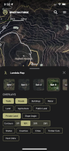
I did see that, but i appreciate it.View attachment 95549
Under content select heading, subheading, or specific pin to filter or unfilter it. Hope this helps one of your complaints!
To me it proves that they could do it right with 10% more effort. But it doesn't really help. I can't isolate duck from hogs or quail or small game, and I can't isolate buck sign from other sign or buck from doe sightings. With huntstand I can tell it to hide everything except one specific type of pin, which is super useful. I can also filter by date and just have it show me this year's pins.
I dig the lidar. But at this point if they don't add features that other folks have before other apps get lidar, I don't get their value proposition. Maybe I'm not the target audience, because while I believe the theory of what they're doing with predictive movement is cool, I'm not seeing real-world value in it at this time
- Joined
- Mar 8, 2022
- Messages
- 4,122
You make a really strong case for Huntstand.I did see that, but i appreciate it.
To me it proves that they could do it right with 10% more effort. But it doesn't really help. I can't isolate duck from hogs or quail or small game, and I can't isolate buck sign from other sign or buck from doe sightings. With huntstand I can tell it to hide everything except one specific type of pin, which is super useful. I can also filter by date and just have it show me this year's pins.
I dig the lidar. But at this point if they don't add features that other folks have before other apps get lidar, I don't get their value proposition. Maybe I'm not the target audience, because while I believe the theory of what they're doing with predictive movement is cool, I'm not seeing real-world value in it at this time
Also a bit random but your love of Lidar did put this Yankees eyes on the best buck he's seen so far( while hunting). Blew it and he was a little outta archery range anyway but the proof is in the pudding I guess. It worked, and for that I thank you Sir.
- Joined
- Nov 1, 2018
- Messages
- 9,350
What land feature did you capitalize on with LiDAR ? Where I hunt military crests and saddles seem to be the best place to catch them moving so I’m trying to pick better spots like that as I learn the terrain features. Something pretty cool about the LiDAR has been seeing all the old logging roads.You make a really strong case for Huntstand.
Also a bit random but your love of Lidar did put this Yankees eyes on the best buck he's seen so far( while hunting). Blew it and he was a little outta archery range anyway but the proof is in the pudding I guess. It worked, and for that I thank you Sir.
- Joined
- Nov 1, 2018
- Messages
- 9,350
I think a filter is a small ask and agree it should already be on there.I did see that, but i appreciate it.
To me it proves that they could do it right with 10% more effort. But it doesn't really help. I can't isolate duck from hogs or quail or small game, and I can't isolate buck sign from other sign or buck from doe sightings. With huntstand I can tell it to hide everything except one specific type of pin, which is super useful. I can also filter by date and just have it show me this year's pins.
I dig the lidar. But at this point if they don't add features that other folks have before other apps get lidar, I don't get their value proposition. Maybe I'm not the target audience, because while I believe the theory of what they're doing with predictive movement is cool, I'm not seeing real-world value in it at this time
I remember when Spartan started, they took money for the development and put a release date that didn't happen for months. When the app finally came out it was about as sad as Apple Maps 1994. So they made more promises that did not turn out to be true. Truth is, I was invested from the beginning and I finally gave up on the guys. It's a scam. I've used them all and have settled on basemap. I wouldn't buy a bag of popcorn from the spartan forge guys. As far as the deer prediction stuff, not even close in any of the areas I've hunted which includes three states. Two midwest and one east coast.
- Joined
- Mar 8, 2022
- Messages
- 4,122
One of those slightly raised areas in a wetter area. I think someone with a better eye or more experience might spot it without lidar but it really pops when all you see is the terrain featuresWhat land feature did you capitalize on with LiDAR ? Where I hunt military crests and saddles seem to be the best place to catch them moving so I’m trying to pick better spots like that as I learn the terrain features. Something pretty cool about the LiDAR has been seeing all the old logging roads.
Something pretty cool about the LiDAR has been seeing all the old logging roads.
I agree. Old logging trails and other stuff is pretty cool to see just how much it stands out on LIDAR.