• The SH Membership has gone live. Only SH Members have access to post in the classifieds. All members can view the classifieds. Starting in 2020 only SH Members will be admitted to the annual hunting contest. Current members will need to follow these steps to upgrade: 1. Click on your username 2. Click on Account upgrades 3. Choose SH Member and purchase.
  • We've been working hard the past few weeks to come up with some big changes to our vendor policies to meet the changing needs of our community. Please see the new vendor rules here: Vendor Access Area Rules

wind data help

Schemeecho

Well-Known Member
Joined
Dec 12, 2020
Messages
313
Location
Gaston, SC.
What's going on yall? I was wondering if anyone knows of web sites to help with wind data. I'm looking to find the common wind direction for different months within deer season. It would be nice if I knew the prevailing wind history of the areas that I will be hunting this season.
 
Dark Sky has a module called time machine that shows historical weather data. Pretty easy to use and awesome but think you can only access it from apple devices.
 
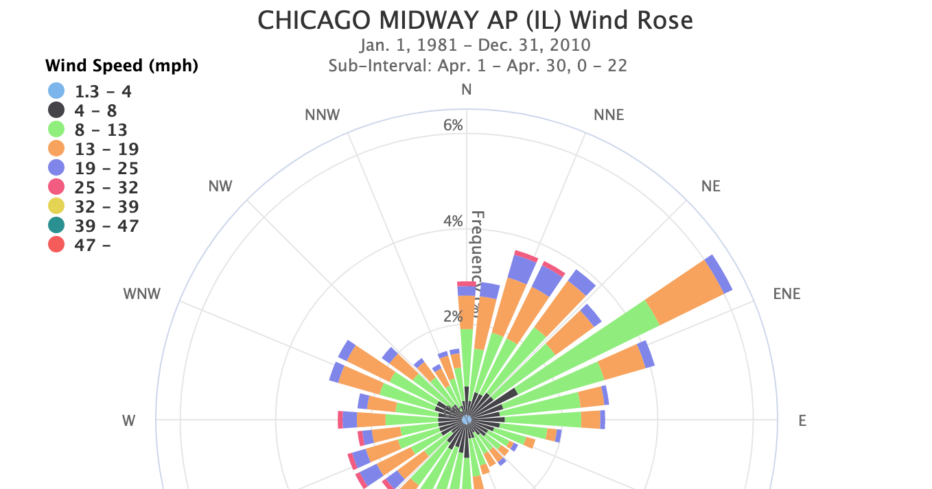
I’ve been down this rabbit hole. It’s deep so lookout. Weather underground used to share historical data in Csv format for free which made this super easy but they stopped which hurt a lot of people using historical weather.Now I just download the noaa data closest to my hunt area for a given year or so.
You usually get wind direction in degrees, you can average across days, weeks, months, or do what I do and time-match the data to observations or trail camera images. Good luck!
 
It’s also helpful if you are really serious about predominant winds to consider wind speed and eliminate winds under 2 mph, you don’t want light variable observations confounding your data. You can also consider exclude severe weather events if you wouldn’t normally hunt them.
 
Very interesting BackSpasm! I never thought to eliminate light winds before but you are right in that they can’t be trusted to be any kind of consistent.

I’ve been down this rabbit hole for a while as well and if you are good at coding you can extract all the exif data from your photos, and then use a API scraper to extract the weather data you are interested in for the days and times on your trail photos. Match them up, filter out the data you don’t trust, and then do some data visualization/look for patterns.

I will mention that there is a company out there called DeerLab which does this for you with trail cam photos but I have no idea where they source their weather data and am not sure I trust it fully. Also, hard to do as much filtering or validation of data as they don’t provide you with a way to export the data. They also don’t include some things that I like to add like last known direction of travel of deer in the trail cam photos which I think is important to look for movement patterns on certain winds!
 
What's going on yall? I was wondering if anyone knows of web sites to help with wind data. I'm looking to find the common wind direction for different months within deer season. It would be nice if I knew the prevailing wind history of the areas that I will be hunting this season.
Imho
It depends on where ya live.
from east coast you can predict weather.
spring and summer is usually south to southwest. Brings the warm and the humidity
Then rest of year its a west nw or north wind cool and dry.
if any eastern winds we know storm coming.
 
I’ve been down this rabbit hole. It’s deep so lookout. Weather underground used to share historical data in Csv format for free which made this super easy but they stopped which hurt a lot of people using historical weather.Now I just download the noaa data closest to my hunt area for a given year or so.
You usually get wind direction in degrees, you can average across days, weeks, months, or do what I do and time-match the data to observations or trail camera images. Good luck!
You can still get free historical data on Weather Underground, but it's based on personal weather stations (PWS) which show surface winds in the exact location of the PWS, they aren't showing prevailing winds. For example, can be a NW prevailing wind, but due to terrain, the surface wind at the location of the PWS could actually be a SE direction when the prevailing wind is NW. I see that example here at my home a lot. There is a PWS less than a half mile from my home and it seldom matches the prevailing wind or the surface wind out my back door. Yet, both locations are under the influence of the same prevailing wind direction.
 
Windfinder.com Don't know how much historical data you'll get from this site but it'll give PWD I use Weather underground for LWD in my valley.
 
I’ve been down this rabbit hole. It’s deep so lookout. Weather underground used to share historical data in Csv format for free which made this super easy but they stopped which hurt a lot of people using historical weather.Now I just download the noaa data closest to my hunt area for a given year or so.
You usually get wind direction in degrees, you can average across days, weeks, months, or do what I do and time-match the data to observations or trail camera images. Good luck!

Any tricks for a situation like this?

A 359 degree and a 1 degree wind should probably average to 0, but would instead average to 180.
 
1st thing is to identify the type of terrain. I can't even imagine how less complicated wind is in flat land compared to hilly terrain.
Predicting surface wind (based on prevailing wind) in hilly terrain is possible in some cases, but it's an art and it's still not 100% dependable. But surface wind in terrain is dictated by prevailing direction and speed. It's a fun challenge to figure it out, especially when everything falls into place.

But one thing that is often not mentioned in wind threads is the terrain. Flat land ain't like hill country.
 
Main thing that helped me is always carrying milk weed when hunting or scouting. Look at the wind direction over the day, paying attention to direction, speed, and whether speed or direction is changing. Then drop milk weed all the time while walking. Imagine that the terrain is like the bottom of a stream and that the wind is like water. You'll begin to understand how wind flows over various terrains and you can start predicting things in advance and travelling and setting up accordingly. I have one location that is nearly impossible to hunt because the wind blows around so much. I get 2 bucks that are huge and look like brothers there. It's not a coincidence that they survived there. Going for them again this year.
 
I think what is being suggested here is to match wind with trail cam photos to see if there are patterns of movement correlated with wind direction. Unless you can stand out there to drop milkweed every time your trail cam snaps a photo, I doubt you will be able to get the information you need from just dropping milkweed while you hunt - Ha!

I agree though it is important to map your properties with milkweed or some other drifter to see how the wind behaves in various conditions. You can use that experience when identifying patterns in mature buck movement in certain locations and their direction of travel to up your odds at crossing their path. For example if you get a south wind but your trail cam is in a bowl and through milkweed mapping you know the wind takes a sharp turn and comes from the west at your trail cam location, you know to change your trail cam data point saying the wind from the south that day was actually a west wind where your trail camera is located. You can also look at times and identify where bucks are likely bedding in certain patterns in conditions for them doing this. Trail cam data analysis is certainly not a new thing but it is not for everyone and takes it to a whole new level of nerdom that most wouldn't find fun. I don't blame anyone for not going down this rabbit hole - Ha!
 
Any tricks for a situation like this?

A 359 degree and a 1 degree wind should probably average to 0, but would instead average to 180.

You can assign wind a quadrants score, such as divide them into 90 degree segments, (NSEW) and then assign them as such, then you can take the mode over a given time frame. The same thing can be accomplished by rounding up or down to the nearest 30 degree increment and finding the mode for the day or week. This will show you the wind that shows up most. In this scenario, a 359 and 1 degree wind would score the same


Edit: basically use mode to find the COMMON wind instead of the average over a given time frame, but for your purposes make the wind directions into something more practical than individual degrees
 
Last edited:
You can still get free historical data on Weather Underground, but it's based on personal weather stations (PWS) which show surface winds in the exact location of the PWS, they aren't showing prevailing winds. For example, can be a NW prevailing wind, but due to terrain, the surface wind at the location of the PWS could actually be a SE direction when the prevailing wind is NW. I see that example here at my home a lot. There is a PWS less than a half mile from my home and it seldom matches the prevailing wind or the surface wind out my back door. Yet, both locations are under the influence of the same prevailing wind direction.
You can view historical data. You can't output historical data sheets with large time ranges to process the data on your own anymore. You have to look up the historical data through their API, this is much less useful for me.
 
Very interesting BackSpasm! I never thought to eliminate light winds before but you are right in that they can’t be trusted to be any kind of consistent.

I’ve been down this rabbit hole for a while as well and if you are good at coding you can extract all the exif data from your photos, and then use a API scraper to extract the weather data you are interested in for the days and times on your trail photos. Match them up, filter out the data you don’t trust, and then do some data visualization/look for patterns.

I will mention that there is a company out there called DeerLab which does this for you with trail cam photos but I have no idea where they source their weather data and am not sure I trust it fully. Also, hard to do as much filtering or validation of data as they don’t provide you with a way to export the data. They also don’t include some things that I like to add like last known direction of travel of deer in the trail cam photos which I think is important to look for movement patterns on certain winds!

I just use some simple code in R to match sightings and trail camera photos to daily predominant winds for target bucks that I capture on camera often, then I can back trace them to their suspected bedding areas for that wind direction based on their travel direction. I pay most attention to dawn/dusk photos and filter the winds for those 3 hours. I have already scouted all of the bedding areas my current #1 lives in, and jumped him in several different beds to figure him out. I shot him last year walking towards one of his favorite spots, but hit him high. By using the data to match camera observations to wind, I have a rough digital pattern on what bedding area he uses under what wind condition, so I know where to intercept him based on a given condition. This type of data is useless for assessing thermals, speed, etc while actually hunting, but my weather app on my phone retrieves wind conditions from the same weather station I get my data from, so even if the predicted wind on my phone is different than the true wind, it matches the predicted wind on the day I already captured him in that location.
 
You can view historical data. You can't output historical data sheets with large time ranges to process the data on your own anymore. You have to look up the historical data through their API, this is much less useful for me.
I don't understand what you are trying to convey. Not saying I disagree with it, I'm saying I'm too dumb to understand what you are saying.
Here's a screen shot of one PWS on Weather Underground (Wundermap) that shows historical data. It can be shown as daily, weekly, or monthly. I would assume most of us would want to see the monthly data for our purposes. If one wants to see a comparison from year to year, that is also possible but it just takes a little more clicking.
But as I said earlier, this is data from a personal weather station which only shows surface data, not prevailing wind data. Surface conditions can change in a matter of just a few yards so I'm skeptical that PWS data would be reliable for wind predicting, especially in hilly terrain. I would much rather see prevailing wind data and then apply it to my knowledge of wind behavior based on the terrain where individual stands are located.
Screen Shot 2021-02-21 at 8.30.40 AM.png
 
I don't understand what you are trying to convey. Not saying I disagree with it, I'm saying I'm too dumb to understand what you are saying.
Here's a screen shot of one PWS on Weather Underground (Wundermap) that shows historical data. It can be shown as daily, weekly, or monthly. I would assume most of us would want to see the monthly data for our purposes. If one wants to see a comparison from year to year, that is also possible but it just takes a little more clicking.
But as I said earlier, this is data from a personal weather station which only shows surface data, not prevailing wind data. Surface conditions can change in a matter of just a few yards so I'm skeptical that PWS data would be reliable for wind predicting, especially in hilly terrain. I would much rather see prevailing wind data and then apply it to my knowledge of wind behavior based on the terrain where individual stands are located.
View attachment 44741

What I mean is, I want to match the data to many trail camera observations of a given buck for instance. Having to go in and manually look up and record the wind for every single day or picture I want to review is very laborious. I used to be able to download all of this as a spreadsheet on my computer and then use software to automatically match the conditions to the date and time with a photo. With one click I could fill in all historical weather data on hundreds of photos at once. Now I must go in and look up each day through the interface you shared here and then record what I found somewhere. Before, when every single record could just be saved to my computer it was much easier to filter through and observe daily averages, wind directions around daw and dusk etc.
 
Back
Top