• The SH Membership has gone live. Only SH Members have access to post in the classifieds. All members can view the classifieds. Starting in 2020 only SH Members will be admitted to the annual hunting contest. Current members will need to follow these steps to upgrade: 1. Click on your username 2. Click on Account upgrades 3. Choose SH Member and purchase.
  • We've been working hard the past few weeks to come up with some big changes to our vendor policies to meet the changing needs of our community. Please see the new vendor rules here: Vendor Access Area Rules

Poor “Recent Imagery”

bigcat93

Well-Known Member
SH Member
Joined
Jul 15, 2015
Messages
1,124
Location
NJ
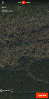
I hop back and forth between some Apps (mainly OnX and SF) but now both of their recent imagery for my area is ****. It’s like they went backwards in time.

And OnX’s recent imagery tab switches it but it’s blurry as hell and can’t even make out what you’re looking at.

Anyone else seeing this issue?
 
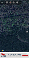
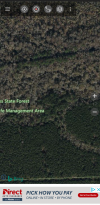
I use huntstand, The monthly satellite is blurry enough to be pointless since I can just get boots on ground anywhere I'm scouting.
 
The best satellite imagery I’ve found is spartan forge UAV layer. I can see individual tree tops laying and see deer trails through swamps/ powerlines


Sent from my iPhone using Tapatalk
 
I run HuntStand and SF. HS always has nice Google style satellite imagery across the board. But might always be super accurate to nuances that might have changed to an area. SF is usually good but also seems hit or miss for my areas. At the end of the day, between the two with imagery and features, I am happy.
 
Are you trying to load a lot of layers all at once including waypoints and related features or is this simply the imagery itself? I’ve found I get better responsiveness keeping many if not most features turned off until I need to look at them and basically just use it for navigation when in the field. If I find waypoints I want to add I do it but then keep them turned off.

If it’s strictly the imagery quality even after everything has loaded up it may be an issue with the aerial ortho photography for that specific area. It may not necessarily be a OnX issue it could just be what’s available photo quality wise for that particular spot.
 
its the same image as google earth, so go there and see if its any better. if not its just the picture the satalite took.
 
Speaking of poor recent imagery, what does everyone think of the new HuntStand update? I think I like it overall although seems like you have to tap around more places to do the same things that only took a couple taps to do/get to before.

Unless I’m missing something, what I DONT like is that it appears that they got rid of the topography lines map. That was a layer I looked at quite a bit. Kinda sucks. Would have much rather seen 3-4 other map layers go away over that one.

Additionally: also now that I’m poking around, noticing all of my hunt areas are different now. Like a lot of stuff is missing that I set up in the areas before. Thats irritating. Also when I tried to get on the computer version, it almost wouldn’t work at all and froze for just about every function. Probably have links to work out but dang. Come one.
 
Last edited:
Speaking of poor recent imagery, what does everyone think of the new HuntStand update? I think I like it overall although seems like you have to tap around more places to do the same things that only took a couple taps to do/get to before.

Unless I’m missing something, what I DONT like is that it appears that they got rid of the topography lines map. That was a layer I looked at quite a bit. Kinda sucks. Would have much rather seen 3-4 other map layers go away over that one.

Additionally: also now that I’m poking around, noticing all of my hunt areas are different now. Like a lot of stuff is missing that I set up in the areas before. Thats irritating. Also when I tried to get on the computer version, it almost wouldn’t work at all and froze for just about every function. Probably have links to work out but dang. Come one.
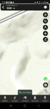
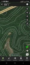
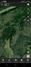
I still have a few layers that show topo lines.

Screenshot_20240921_191558.jpgScreenshot_20240921_191519.jpgScreenshot_20240921_191502.jpg
 
It looks like you’re still on the old version there. If you update the app to the new version it looks totally different than that one.

In hind sight kind of wish they would have stayed with that one or at least didn’t make such a drastic change all at once.
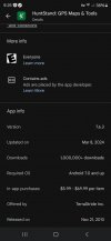
I'm on the latest Android version of HuntStand Pro.
Screenshot_20240921_212544_Google Play Store.jpg
 
Back
Top